Attached files
| file | filename |
|---|---|
| 8-K - FORM 8-K - G REIT Liquidating Trust | d490071d8k.htm |
| EX-10.2 - EX-10.2 - G REIT Liquidating Trust | d490071dex102.htm |
| EX-10.6 - EX-10.6 - G REIT Liquidating Trust | d490071dex106.htm |
| EX-10.5 - EX-10.5 - G REIT Liquidating Trust | d490071dex105.htm |
| EX-10.8 - EX-10.8 - G REIT Liquidating Trust | d490071dex108.htm |
| EX-10.3 - EX-10.3 - G REIT Liquidating Trust | d490071dex103.htm |
| EX-10.1 - EX-10.1 - G REIT Liquidating Trust | d490071dex101.htm |
Exhibit 10.4
RECORDING REQUESTED BY
First American Title Insurance Company National
Commercial Services
AND WHEN RECORDED MAIL DOCUMENT TO:
Chequers-Sutter Square, LLC
c/o Sovereign Capital Management Group, Inc
750 B St., Ste 2620
San Diego, CA 92101
Space Above This Line for Recorder’s Use Only
| A.P.N.: 007-0117-001 | File No.: NCS-537875-SD (JH) |
GRANT DEED
The undersigned Grantor(s) declare(s) that Documentary Transfer Tax shall be shown on a separate Declaration or Statement of Tax Due and not of public record pursuant to revenue & taxation code 11932-11933.
FOR A VALUABLE CONSIDERATION, receipt of which is hereby acknowledged, GREIT-Sutter Square, L.P., a California limited partnership, who acquired title as GREIT-Sutter Square, LP, a California limited partnership,
hereby GRANTS to Chequers-Sutter Square, LLC, a California limited liability company, the following described property in the City of Sacramento, County of Sacramento, State of California:
Legal Description attached hereto as Exhibit “A” and incorporated herein by this reference
Mail Tax Statements To: SAME AS ABOVE
Grant Deed - continued
Date: 12/18/2012
| A.P.N.: 007-0117-001 | File No.: NCS-537875-SD (JH) |
Dated: 12/18/2012
GREIT-Sutter Square, LP, a California limited
partnership
| By: | GREIT-Sutter Square GP, LLC, a Delware limited liability company | |
| By: | G REIT Liquidating Trust, a Maryland Trust, as successor in interest to GREIT L.P., a Virginia limited partnership (as dissolved) and its General Partner, G REIT Inc., a Maryland corporation (as dissolved), pursuant to Agreement and Declaration of Trust dated January 22, 2008 | |
| By: | /s/ Gary T. Wescombe | |
| Gary T. Wescombe, Chairman of Trustees |
Page 2 of 4
Grant Deed - continued
Date: 12/18/2012
| STATE OF California | )SS | |||
| COUNTY OF Orange | ) |
On 12/20/2012 before me, Lora Lee, Farve Notary Public, personally appeared Gary Wescombe, who proved to me on the basis of satisfactory evidence to be the person(s) whose name(s) is/are subscribed to the within instrument and acknowledged to me that he/she/they executed the same In his/her/their authorized capacity(ies), and that by his/her/their signature(s) on the instrument the person(s), or the entity upon behalf of which the person(s) acted, executed the instrument.
I certify under PENALTY OF PERJURY under the laws of the State of California that the foregoing paragraph is true and correct.
| WITNESS my hand and official seal. |
| |||
| Signatures | ||||
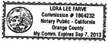
| Lora Lee Farve |
||||
| My Commission Expires: 9/7/13 | This area for official notarial seal | |||
| Notary Name: Lora Lee Farve | Notary Phone: 714-876-4522 | |||
| Notary Registration Number: 1864232 | County of Principal Place of Business: | |||
Page 3 of 4
Grant Deed - continued
Date: 12/18/2012
| A.P.N.: 007-0117-001 | File No.: NCS-537875-SD (JH) |
EXHIBIT A
THAT PORTION OF THE BLOCK BOUNDED BY 29TH AND 30TH, “J” AND “K” STREETS IN THE CITY OF SACRAMENTO, CALIFORNIA, DESCRIBED AS FOLLOWS:
BEGINNING AT A POINT DISTANT NORTH 54° 01’ 38” EAST 43.05 FEET FROM THE INTERSECTION OF THE CENTERLINE OF 29TH AND “K” STREETS; THENCE FROM SAID POINT OF BEGINNING PARALLEL WITH AND 25.00 FEET SOUTHEASTERLY (MEASURED AT RIGHT ANGLES) FROM SAID CENTERING OF 29TH STREET NORTH 18° 31’ 25” EAST 299.67 FEET; THENCE ALONG A TANGENT CURVE TO THE RIGHT WITH A RADIUS OF 250.00 FEET, THROUGH AN ANGLE OF 10° 50’ 18” AN ARC DISTANCE OF 47.29 FEET; THENCE SOUTH 71° 32’ 20” EAST 10.86 FEET; THENCE FROM A TANGENT THAT BEARS NORTH 64° 40’ 57” EAST ALONG A CURVE TO THE RIGHT WITH A RADIUS OF 18.00 FEET, THROUGH AN ANGLE OF 43° 45’ 43” AN ARC DISTANCE OF 13.75 FEET TO A POINT 35.00 FEET SOUTHWESTERLY (MEASURED AT RIGHT ANGLES) FROM THE CENTERLINE OF T STREET; THENCE PARALLEL WITH SAID CENTERLINE OF T STREET, S 71° 33’ 20” EAST 324.85 FEET TO A POINT 25.00 FEET NORTHWESTERLY (MEASURED AT RIGHT ANGLES) FROM THE CENTERLINE OF 30TH STREET; THENCE PARALLEL WITH THE CENTERLINE OF 30TH STREET, SOUTH 18° 31’ 47” WEST 214.72 FEET; THENCE NORTH 71° 28’ 13” WEST 15.00 FEET; THENCE NORTH 18° 31’ 47” EAST 29.00 FEET; THENCE NORTH 71° 28’ 13” WEST 35.00 FEET; THENCE SOUTH 18° 31’ 47” WEST 70.00 FEET; THENCE SOUTH 71° 28’ 13” EAST 35.00 FEET; THENCE NORTH 18° 31’ 47” EAST 29.00 FEET; THENCE SOUTH 71° 28’ 13” EAST 15.00 FEET TO A POINT 25.00 FEET NORTHWESTERLY (MEASURED AT RIGHT ANGLES) FROM THE CENTERLINE OF 30TH STREET; THENCE PARALLEL WITH SAID CENTERLINE OF 30TH STREET SOUTH 18° 31’ 47” WEST 124.82 FEET TO A POINT 35.00 FEET NORTHEASTERLY (MEASURED AT RIGHT ANGLES) FROM THE CENTERLINE OF “K” STREET; THENCE PARALLEL WITH THE CENTERLINE OF “K” STREET NORTH 71° 34’ 37” WEST 352.57 FEET TO THE POINT OF BEGINNING.
EXCEPTING THEREFROM ALL THOSE PORTIONS OF THE ABOVE-DESCRIBED PROPERTY OCCUPIED BY THE SUPPORTS AND FOUNDATIONS OF THE VIADUCT.
ALSO EXCEPTING THEREFROM ALL THAT PORTION OF SAID PROPERTY ABOVE A HORIZONTAL PLANE 4 FEET BELOW THE UNDERSIDE OF THE SUPERSTRUCTURE OF THE VIADUCT, WHICH PLANE EXTENDS TO A UNE 4 FEET, MEASURED HORIZONTALLY BEYOND THE PROTRUSION OF THE SUPERSTRUCTURES OF SAID VIADUCT, AS SHOWN ON THE DIAGRAM MARKED EXHIBIT “B” ATTACHED HERETO ANY BY THIS REFERENCE MADE A PART HEREOF.
Page 4 of 4