Attached files
| file | filename |
|---|---|
| 8-K - FORM 8-K - G REIT Liquidating Trust | d374519d8k.htm |
| EX-10.1 - EX-10.1 - G REIT Liquidating Trust | d374519dex101.htm |
| EX-10.2 - EX-10.2 - G REIT Liquidating Trust | d374519dex102.htm |
| EX-10.4 - EX-10.4 - G REIT Liquidating Trust | d374519dex104.htm |
Exhibit 10.3
| Electronically Recorded Official Public Records
Mary Louise Garcia |
Tarrant County Texas 6/18/2012 11:44 AM PGS 5 $32.00 Submitter: LANDATA |
D212145146 |
SPECIAL WARRANTY DEED
| STATE OF CALIFORNIA |
§ |
|||
| § |
KNOW ALL MEN BY THESE PRESENTS | |||
| COUNTY OF ORANGE |
§ |
THAT THE UNDERSIGNED, G REIT—Western Place, LP, a Texas limited partnership, hereinafter called “Grantor”, for and in consideration of the sum of TEN DOLLARS ($10.00) and other valuable consideration to the undersigned in hand paid by the Grantee herein named, whose address is c/o G REIT Liquidating Trust, 1551 N. Tustin Avenue, Suite 200, Santa Ana, CA 92705, the receipt of which is hereby acknowledged, has GRANTED, SOLD AND CONVEYED, and by these presents docs GRANT, SELL AND CONVEY unto ARPT Western Place Owner, LLC, a Delaware limited liability company, herein called “Grantee” as to an undivided 78.5% interest in the real property (the “Property”) described on the attached Schedule A, together with all of Grantor’s right, title and interest, if any, to any and all improvements thereon, and any and all mineral rights or interests of Grantor relating thereto.
TO HAVE AND TO HOLD the Property together will all and singular rights and appurtenances thereto in anywise belonging unto Grantee, its successors and assigns forever, subject to the matters herein stated; and Grantor does hereby bind its and its successors and assigns to WARRANT AND FOREVER DEFEND all and singular the Property unto Grantee, its successors and assigns, against every person whomsoever lawfully claiming or to claim the same or any part thereof, by, through and under Grantor but not otherwise.
GRANTEE ACKNOWLEDGES THAT THE CONVEYANCE OF THE PROPERTY IS SPECIFICALLY MADE “AS IS”, “WHERE-IS” AND “WITH ALL FAULTS”, WITHOUT ANY REPRESENTATIONS OR WARRANTIES EXPRESS OR IMPLIED (EXCEPT FOR THE SPECIAL WARRANTY OF TITLE SET FORTH IN THIS DEED AND ANY SPECIFIC REPRESENTATION OR WARRANTY MADE TO GRANTEE IN THAT CERTAIN PURCHASE AGREEMENT AND ESCROW INSTRUCTIONS BETWEEN GRANTEE, AS BUYER, AND GRANTOR, AS SELLER (THE “AGREEMENT”)), INCLUDING WITHOUT LIMITATION, IMPLIED WARRANTIES OF FITNESS FOR ANY PARTICULAR PURPOSE OR MERCHANTABILITY OR ANY OTHER WARRANTIES WHATSOEVER CONTAINED IN OR CREATED BY THE TEXAS BUSINESS AND COMMERCE CODE OR OTHERWISE. EXCEPT AS EXPRESSLY SET FORTH HEREIN OR IN THE AGREEMENT, GRANTOR SHALL HAVE NO LIABILITY TO GRANTEE, AND GRANTEE HEREBY RELEASES GRANTOR FROM ANY LIABILITY (INCLUDING CONTRACTUAL AND/OR STATUTORY ACTIONS FOR CONTRIBUTION OR INDEMNITY), FOR, CONCERNING OR REGARDING (1) THE NATURE AND CONDITION OF THE PROPERTY, INCLUDING SUITABILITY THEREOF FOR ANY ACTIVITY OR USE; (2) ANY IMPROVEMENTS OR SUBSTANCES LOCATED THEREON; OR (3) THE COMPLIANCE OF THE PROPERTY WITH ANY LAWS, RULES, ORDINANCES OR REGULATIONS OF ANY GOVERNMENT OR OTHER BODY. THE FOREGOING INCLUDES A RELEASE OF GRANTOR FROM CLAIMS BASED ON GRANTOR’S NEGLIGENCE IN WHOLE OR IN PART AND CLAIMS BASED ON STRICT LIABILITY. GRANTEE ACKNOWLEDGES THAT NEITHER GRANTOR NOR ANY OF ITS AGENTS HAVE MADE, AND SPECIFICALLY NEGATE AND DISCLAIM, ANY REPRESENTATIONS, WARRANTIES, PROMISES, COVENANTS, AGREEMENTS OR GUARANTIES OR ANY KIND OR CHARACTER, WHATSOEVER, WHETHER EXPRESS OR IMPLIED, ORAL OR WRITTEN, OF, AS TO, CONCERNING, OR WITH RESPECT TO, (i) THE VALUE, NATURE, QUALITY OR CONDITION OF THE PROPERTY, INCLUDING WITHOUT LIMITATION, THE WATER, SOIL, AND GEOLOGY, (ii) THE SUITABILITY OF THE PROPERTY FOR ANY AND ALL ACTIVITIES AND USES WHICH MAY BE CONDUCTED THEREON, (iii) THE COMPLIANCE OF OR BY THE PROPERTY WITH ANY LAWS, RULES, ORDINANCES OR REGULATIONS OF ANY APPLICABLE GOVERNMENTAL AUTHORITY, (iv) THE HABITABILITY, MERCHANTABILITY,
MARKETABILITY, PROFITABILITY OR FITNESS FOR A PARTICULAR PURPOSE OF THE PROPERTY, OR (v) ANY OTHER MATTER WITH RESPECT TO THE PROPERTY, AND SPECIFICALLY, THAT NEITHER GRANTOR NOR ANY OF ITS AGENTS HAVE MADE AND SPECIFICALLY DISCLAIM, ANY REPRESENTATIONS OR WARRANTIES REGARDING COMPLIANCE OF THE PROPERTY WITH ANY ENVIRONMENTAL PROTECTION, POLLUTION OR LAND USE LAWS, RULES, REGULATIONS, ORDERS OR REQUIREMENTS, INCLUDING WITHOUT LIMITATION, THOSE PERTAINING TO SOLID WASTE, AS DEFINED BY THE U.S. ENVIRONMENTAL PROTECTION AGENCY REGULATIONS AT 40 C.F.R. PART 261, OR THE DISPOSAL OR EXISTENCE, IN OR ON THE PROPERTY, OF ANY HAZARDOUS SUBSTANCES, AS DEFINED BY THE COMPREHENSIVE ENVIRONMENTAL RESPONSE COMPENSATION AND LIABILITY ACT OF 1980, AS AMENDED, AND THE REGULATIONS PROMULGATED THEREUNDER. GRANTEE SHALL RELY SOLELY ON ITS OWN INVESTIGATION OF THE PROPERTY AND NOT ON ANY STATEMENTS, REPRESENTATIONS, WARRANTIES OR INFORMATION MADE OR PROVIDED OR TO BE PROVIDED BY GRANTOR OR ITS AGENTS OR CONTRACTORS. GRANTOR SHALL NOT BE LIABLE OR BOUND IN ANY MANNER BY ANY VERBAL OR WRITTEN STATEMENTS, REPRESENTATIONS, WARRANTIES OR INFORMATION PERTAINING TO THE PROPERTY OR THE OPERATION THEREOF, FURNISHED BY ANY PARTY PURPORTING TO ACT ON BEHALF OF GRANTOR. GRANTEE FURTHER ACKNOWLEDGES THAT THE PROVISIONS OF THIS PARAGRAPH HAVE BEEN FULLY EXPLAINED TO GRANTEE AND THAT GRANTEE FULLY UNDERSTANDS AND ACCEPTS THE SAME.
EXECUTED this 12th day of June, 2012.
| GRANTOR: | ||||||||||
| GREIT—Western Place, LP, a Texas limited partnership | ||||||||||
| By: | GREIT—Western Place GP, LLC, a Delaware limited liability company, its General Partner | |||||||||
| By: | G REIT Liquidating Trust, a Maryland trust, its sole member | |||||||||
| By: | /s/ Gary T. Wescombe | |||||||||
| Gary T. Wescombe, Trustee | ||||||||||
| STATE OF CALIFORNIA | ) | |
| ) ss. | ||
| COUNTY OF ORANGE | ) |
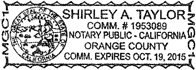
On June 12, 2012, before me, Shirley A. Taylor, a Notary Public in and for said County and State, personally appeared Gary T. Wescombe, who proved to me on the basis of satisfactory evidence to be the person whose name is subscribed to the within instrument and acknowledge to me that he/she/they executed the same in his/her/their authorized capacity, and that by his/her/their signature on the instrument the person, or the entity upon behalf of which the person acted, executed the instrument.
I certify under PENALTY of PERJURY under the laws of the State of California that the foregoing paragraph is true and correct.
WITNESS my hand and official seal.
| /s/ Shirley A. Taylor |
| Notary Public |
|
SCHEDULE A
LEGAL DESCRIPTION
TRACT 1:
Being a 10.890 acre tract of land, a portion of the Peterson Pate Survey, Abstract No. 1202 and the J.A. Bowers Survey, Abstract No. 87, situated in the City of Fort Worth, Tarrant County, Texas, and being all of Lot 2-R and a portion of Lot 1-R1, WESTOVER RIDGE ADDITION to the City of Fort Worth, Tarrant County, Texas, according to the plat recorded in Volume 388-96, Page 14, Plat Records, Tarrant County, Texas, same being all of that certain tract of land described as Tract 1 in deed to Harris Professional Building Corporation recorded in Volume 11622, Page 239, Deed Records, Tarrant County, Texas. The bearings for this description are based on the bearings of the most northerly northwest property line of the said Harris Professional Building Corporation, as it appears in Volume 388-96, Page 14, Plat Records, Tarrant County, Texas. Said 10.890 acre tract being described by metes and bounds as follows:
Beginning at a 1/2" iron rod found at the intersection of the east right of way line of Westridge Avenue, a 60' public right of way and the south right of way of Pershing Avenue, a variable width right of way, 60' wide at this point, for the northwest corner of the said Lot 2-R, Westover Ridge Addition;
THENCE continuing along the south right of way line of the Pershing Avenue, the following courses:
North 90°00'00" East, a distance of 447.74 Feet to a 1/2" iron rod found for the beginning of a curve, concave to the south, having a radius of 707.26 Feet, a central angle of 23°05'39" and a chord which bears South 78°27'11" East, a distance of 283.15 Feet;
Easterly along the arc of the said curve, a distance of 285.07 Feet to a 1/2" iron rod found;
South 67°06'04" East, a distance of 173.47 Feet to an “X” cut in concrete for the beginning of a curve, concave to the north, having a radius of 516.81 Feet a central angle of 23°13'03", and a chord of 207.99 Feet bearing South 78°37'31" East;
Southeasterly along said curve, a distance of 209.42 Feet to a 1/2" iron rod found;
North 89°45'47" East, a distance of 83.44 Feet to a 1/2" iron rod found;
THENCE South 0°11'00" East, leaving the south right of way line of Pershing Avenue and continuing over and across said Lot 1-R1, a distance of 300.29 Feet to an “X” cut found on the north right of way line of Interstate Highway No. 30, a variable width public right of way;
THENCE South 89°27'00" West, along the said north right of way line, a distance of 1133.82 Feet to an “X” cut set at the intersection of the north right of way line of Interstate Highway No. 30 and the east right of way line of the said Westridge Avenue;
THENCE continuing along the said east right of way line of Westridge Avenue, the following courses:
North 0°33'00" West, a distance of 138.08 Feet to a 1/2" iron rod with cap stamped “RPLS 4818” found at the beginning of a curve, concave to the west, having a radius of 1383.71 Feet, a central angle of 8°27'04" and a chord which bears North 4°46'28" West, a distance of 203.92 Feet;
Northerly along said curve, a distance of 204.10 Feet to a 1/2" iron rod found;
North 9°00'00" West, a distance of 117.10 Feet to the beginning of a curve, concave to the west, having a radius of 1240.55 Feet, a central angle of 0°53'31" and a chord which bears North 8°35'45" West, a distance of 19.31 Feet;
Northerly along said curve, a distance of 19.31 Feet to the POINT OF BEGINNING; and containing a computed area of 10.890 Acres, more or less.
TRACT 2:
Being a 2.043 acre tract of land out of the Peterson Pate Survey, Abstract No. 1202 and the J.A. Bowers Survey, Abstract No. 87, located in the City of Fort Worth, Tarrant County, Texas, and being a portion of Lot 1-R1, Tract B, Westover Ridge Addition to the City of Fort Worth, Tarrant County, Texas, recorded in Volume 388-96, Page 14, Plat Records, Tarrant County, Texas, and a portion of Lot 6R, Block 1, Westover Ridge Addition to the City of Fort Worth, Texas, recorded in Volume 388-89, Pages 45 and 46, Plat Records, Tarrant County, Texas, and a portion of Lots 8 and 9, Block 1, West Ridge Addition to the City of Fort Worth, Texas, recorded in Volume 1807, Page 305, Deed Records, Tarrant County, Texas, same being all of that certain tract of land described Volume 12133, Page 1805, Deed Records, Tarrant County, Texas. The bearings for this survey are based on the bearing of the most northerly northwest line of Lot 2R, Tract B, Westover Ridge Addition, recorded in Volume 388-96, Page 14, Plat Records, Tarrant County, Texas. Said 2.043 acre tract being described by metes and bounds as follows:
Beginning at a 1/2" iron rod found on the south right of way line of Pershing Avenue, a variable width public right of way, 50' wide at this point and being on the north line of said Lot 1R-1, Tract B Westover Hills Addition, lying, by deed call South 89°47'00" West, a distance of 240.60 Feet from the most northerly northeast corner of said Lot 1R-1
THENCE North 89°46'19" East, along the said south right of way line of Pershing Avenue, passing at a distance of 240.60 feet the said northeast corner of Lot 1R-1 and continuing along the north line of Lot 9, Block 1, of said West Ridge Addition, a total distance of 346.56 Feet to an “X” cut in concrete found in the west boundary of that certain tract of land described in deed to the State of Texas, Recorded in Volume 7471, Page 1316, Deed Records, Tarrant County, Texas and being the west right of way line of Guilford Road;
THENCE continuing along the west and north lines of the said State of Texas tract, the following courses;
South 0°21'36" West, a distance of 242.72 Feet to a 1/2" iron rod with cap stamped “RPLS 1607” found;
South 44°07'47" West, a distance of 14.74 Feet to a Texas Department of Transportation, (TXDOT) brass disk found in concrete;
South 89°18'21" West, a distance of 243.61 Feet to a 3/4" iron rod found;
South 70°49'09" West, a distance of 31.64 Feet to a TXDOT brass disk found in concrete;
South 89°27'50" West, a distance of 49.93 Feet to a TXDOT brass disk found in concrete;
South 1°06'55" East, a distance of 34.56 Feet to an “X” found in concrete on the north right of way line of Interstate Highway No. 30 a variable width controlled access right of way;
THENCE South 89°47'44" West along the said north right of way line of said IH No. 30, a distance of 11.16 Feet to an “X” found in concrete;
THENCE North 0°11'00" West, a distance of 300.29 Feet to the POINT OF BEGINNING; and containing a computed area of 2.043 Acres, more or less.